82km Ascot to Hungerford

Ride overview
The day has a totally different feel to yesterday. The geology changes from clay to sand and gravel, so that the riding is over sandy heaths and through forests of pine trees. For much of the day, you ride on the old Roman road to Silchester and it’s lovely riding; always varied, always surprising; expect anything from Caesar’s old camp (although he never went there), a nuclear weapons manufacturing plant and the infamous Greenham Common, where the US stored their cruise missiles and countless women protested in the 1980s. And between the extremes there are well maintained villages, country parks and winding lanes around sheep-grazed fields at the foot of the North Wessex Downs.


Ride Practicalities
START/FINISH: Ascot/The Bruce Inn (or Hungerford) DISTANCE: 82km TOTAL ASCENT: 658m TERRAIN AND SURFACES: A mix of segregated cycleways and firm forest tracks which can be muddy after heavy rain. The second half of the route is on minor country roads FOOD: Swinley Forest, Bracknell, Woodlarks, Aldermaston, The Hind’s Head, Newbury, The Tiny Cafe, Great Bedwyn, The Old Post Office, Easton Royal, The Bruce Arms ACCOMMODATION; Easton Royal, The Bruce Arms camping, Pewsey Vale, Wild Camping Wiltshire MAINLINE TRAIN SERVICES: Newbury, Hungerford, Great Bedwyn LINKS TO OTHER RIDES: February Magic, NCN 4
To return to stage 1, click here
To go to stage 3, click here
Ride Notes
Whilst out riding in 1711, Queen Anne saw the potential for a racecourse at East Cote, declaring it looked an ideal place for ‘horses to gallop at full stretch’. The first race took place soon after with a prize worth 100 guineas open to any horse aged six or more. The horse had to carry a weight of 12 stone and run for four miles. Today, that same course, is still used, (although the jockeys are lighter) and has many meetings throughout the year, including one of the world’s most esteemed races; The Gold Cup. The day’s ride begins outside the gates to the fabulous grandstand.

Ascot Racecourse
Ascot for all its hosting of the sport of Kings, is rather a tatty town. You ride on a shared path runs beside the A329. Few pedestrians use it - cars are king in the Royal County of Berkshire - so progress is usually unimpeded. After a kilometre or so, look out for a signpost, marked, ‘Blue Route Superstore and Martin’s Heron’. Despite the rather disheartening name, it is a well maintained bike path through woods and houses and is a perfectly pleasant ride.

The bike path from Ascot to Martin's Heron and onto Swinley Forest
Swinley Forest is the second Royal forest of the route. Within it, there are scout camps, walks and mountain bike trails, along with a good cafe; Woodlarks. Riding through the forest is brilliant; tall and mature pines and straight forest drives on which Roman legions once trod. A few metres off the route, is an Iron Age Camp, known for some reason as Caesar’s camp - despite the fact that Julius Ceasar arrived some 750 years after its construction and certainly never came this far into Britain. Surprisingly, given the several straight-line kilometres of Roman road, navigation can be a challenge. There are one or two turnings and deep in the forest paths tend to look the same, so follow the on-line map carefully. As ever, it helps to have a downloadable OS app on your phone. Within the forest, are several marked MTB trails, one of which runs for a while alongside the route. Riding it with a fully laden bike brings out the kid in you and is definitely a highlight - there is the normal track beside it for those who don’t fancy it.

A mountain bike trail in Swinley Forest.
Once through the forest, the route enters armed forces country. (Sandhurst is up the road, as is Aldershot, one of the army’s main bases). Arborfield Garrison, used since 1907 was sold for development at the turn of the century and it is being transformed into 3,500 homes. It’s perhaps not the most enlivening of routes, but does not last long and the cycling is pleasant and undemanding.

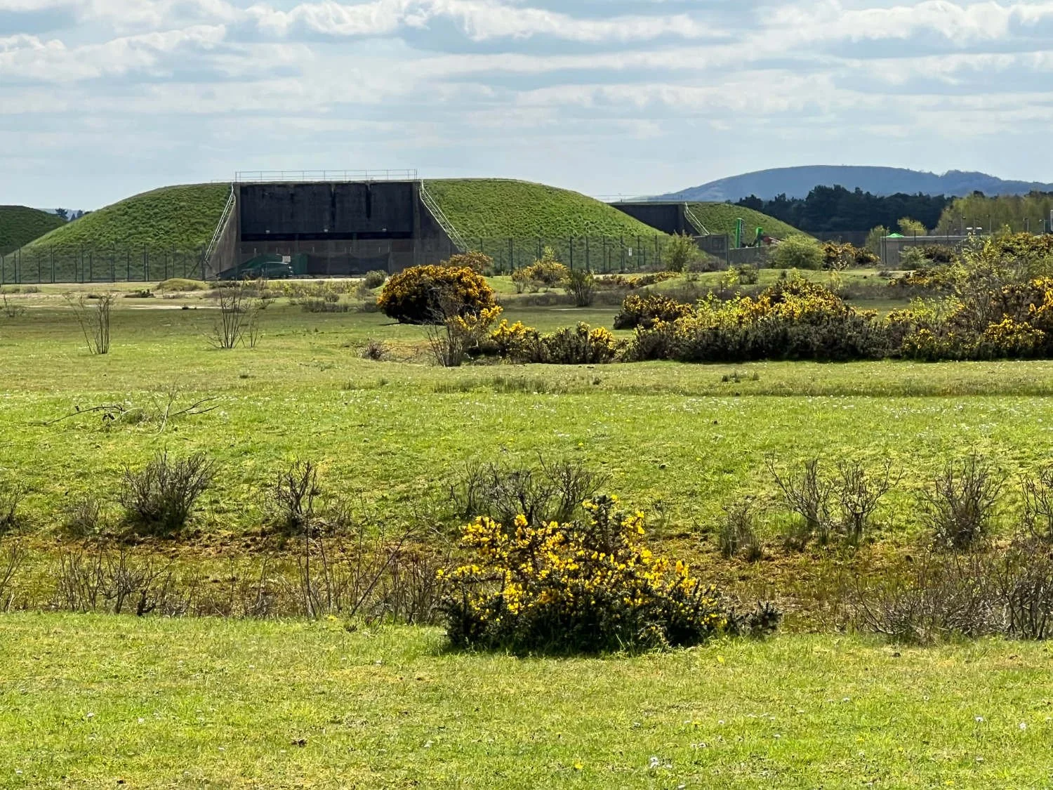
Aldermaston Nuclear Weapons Facility (AWE)
Once past the garrisons old and new, the route continues its armed forces link. Aldermaston, one of Berkshire’s prettier villages, is also home to a nuclear weapons facility - you’ll see the chain-linked fence, the barbed wire and cameras behind the trees as you ride. For a major industrial plant, it’s spookily silent. Soon after, you arrive at Greenham Common. Until the 1990s, this is where the Americans stored their nuclear cruise missiles and where up to 50,000 women set up camp seeking their removal. Greenham, together with Crookham Common forms the largest continuous tract of open heath in Berkshire, the gravel beds having been laid down at the end of the last Ice Age. It’s hard to imagine as you ride along the superb gravel path that over 10,000 sorties left the airfield during the invasion of Normandy. Today, the commons are home to nightjars, lady’s tresses orchids, woodlarks, cows and in spring, swathes of coconut smelling gorse.

Greenham Common, once an airbase, now home to rare wildlife.
After the bird singing of the Commons, there’s Newbury. The centre of town now pedestrianised, is a quintessential southern market town of gracious coaching inns and resplendent Georgian town houses. Newbury was much fought over in the English Civil War, as it was (and still is) an important crossroads. The battlefield is now covered in housing estates, and the only evidence of the bloody fight is the Falkland monument dedicated to Lucius Cary, Viscount Falkland, Charles I’s Secretary. Frustrated by the stalemate in the fighting, and in a rush of ill-advised passion, he charged the Parliamentary lines and was instantly cut down by musket fire. The battle continued into the evening, finishing when the Royalists withdrew, having run out of powder and ammunition, leaving the way to London open for the Parliamentarians.

The Berkshire Downs in spring
Once through Newbury, a very different geological scene awaits - chalkland. You’ll see the ridge of the Berkshire Downs rising in the south, its steep scarp slope overlooking the rolling country of the Kennet valley. You ride on small country lanes which are roofed by arching trees. Many of the sheep which graze in the fields are Hampshire Downlands with their slightly squashed faces, black noses and dense white wool, which is often used in Japanese futons. Pretty villages, houses mixed with brick and flint, grand estates with avenues of limes and poplars, colour the route.
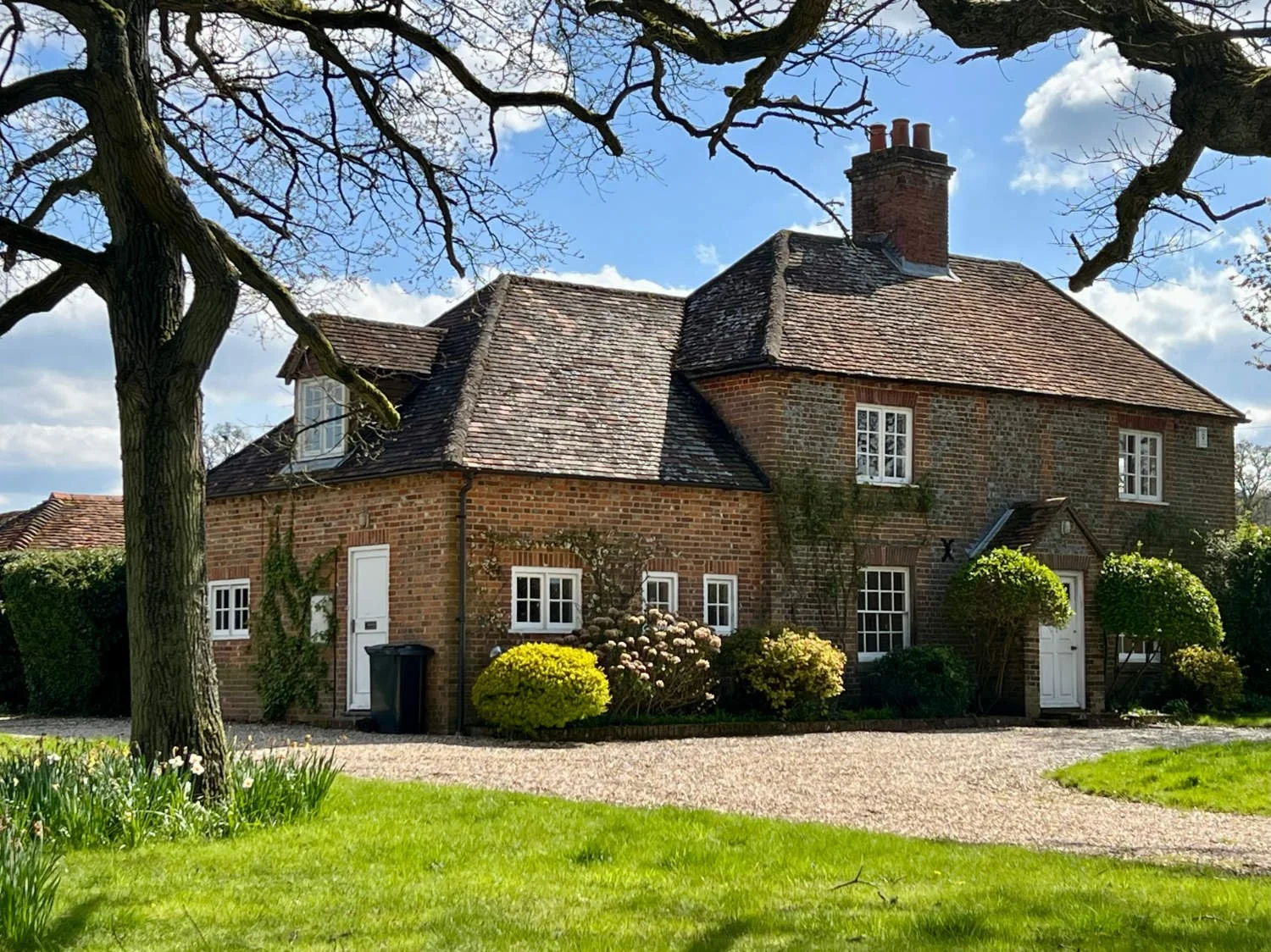
The cottages and houses change from brick to flint and thatch as you ride westwards
The approach to Hungerford is across the commons of Port Down, the name of which derives from the French ‘porte’ (door) and the Saxon ‘dun’ (hill) - the door to the hills - an appropriate name for what is to come. It has been managed as common land since the fourteenth century. In low light you can still see the lynchets of the medieval farm systems. Hungerford is sometimes known as the ‘crossroads of England’ - and the high street is predictably busy. There are many old inns, one of which The Bear. Henry VIII gave it to his fifth wife, Anne of Cleves and a century or so later the Prince of Orange, later William III, negotiated in his bed-chamber, a peaceful hand-over of the English throne. You may choose to stay here or any of the other inns in town, or head onto to either of the nearby campsites; the Bruce Arms or Wild Camping Wiltshire.